Technology
- Home
- Technology
- News
A tiny satellite showed it can take high-res pics from space
Tokyo-based startup ArkEdge Space claims it has snapped what is “probably” the highest quality images of Earth taken by a small CubeSat. The photos were taken 410 kilometers above the Earth’s surface by the company’s CubeSat called ONGLAISAT, co-developed by …

Published 2 years ago on Feb 13th 2025, 10:00 am
By Web Desk
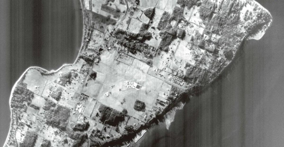
Tokyo-based startup ArkEdge Space claims it has snapped what is “probably” the highest quality images of Earth taken by a small CubeSat. The photos were taken 410 kilometers above the Earth’s surface by the company’s CubeSat called ONGLAISAT, co-developed by Taiwan’s space agency TASA.
It has precision attitude control, a TASA-developed Korsch off-axis optical system, a CMOS TDI (Time Delay and Integration) image sensor, and image compression hardware that all fits inside its 6U form factor, which is about the size of a desktop computer or suitcase.
[Image: Satellite shot of Camano Island, Washington, USA. https://platform.theverge.com/wp-content/uploads/sites/2/2025/02/%E6%97%BA%E4%BE%86%E8%A1%9B%E6%98%9F%E5%8F%96%E5%83%8F%E8%8F%AF%E7%9B%9B%E9%A0%93%E5%B7%9E%E5%8D%A1%E9%A6%AC%E8%AB%BE%E5%B3%B6.jpg_ae60debd-fa65-445b-a775-5d53195d7fa2.webp?quality=90&strip=all]
ArkEdge Space shared black and white images zoomed into areas as close as one square kilometer, showing buildings and roads with some details near Seattle and from the Patagonia region of Argentina. The company claims it captured the “world’s highest ground resolutions” in the CubeSat category, ranging from 2.5 to 3 meters. Reuters reports its mission is expected to end in March before its optical tech is applied to future missions, quoting ArkEdge CEO Takayoshi Fukuyo saying, “The pictures are as clear as aerial photography (despite) being taken by a satellite of this size.”
The ONGLAISAT mission objectives were to demonstrate the optical system in orbit, test a University of Tokyo co-developed altitude control system, and validate the TDI and process images, which all succeeded. The satellite was delivered to the ISS in November and then they were deployed from the Japanese Experiment Module “Kibo” on December 10th.
[Image: Release satellite: ONGLISAT https://platform.theverge.com/wp-content/uploads/sites/2/2025/02/74071_j-ssod30-3rd_01-thumb-600x470-17502.jpg?quality=90&strip=all]

US military weighs use of ‘mother of all bombs’ in potential future strikes on Iran, CNN says
- 10 گھنٹے قبل

National Grid Company of Pakistan unveils new brand identity as “National Grid Pakistan”
- 8 گھنٹے قبل

‘Pure insanity’: Mathematicians will need years to make sense of OpenAI’s latest drop
- 21 گھنٹے قبل

Five terrorists killed in Washuk IBO, Balochistan: ISPR
- 11 گھنٹے قبل
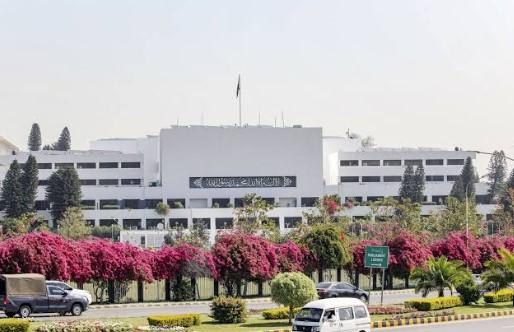
Joint Session of Parliament ratifies emergency, governor’s rule in KP
- 9 گھنٹے قبل

The Supreme Court may be about to make America’s prisons much crueler
- 19 گھنٹے قبل

At least 30 children, two teachers killed in Peshawar school roof collapse
- 11 گھنٹے قبل

CDF Munir reaffirms resolve to strengthen Pakistan-Russia ties
- ایک دن قبل

Pakistan pursuing investment, export-led growth: FinMin Aurangzeb
- 6 گھنٹے قبل

K-pop star Sunmi loves Notion and ear cleaning videos
- 21 گھنٹے قبل

The rise and fall of a MAGA princess
- 19 گھنٹے قبل

Microsoft 365 Family subscribers will finally be able to share AI benefits
- 21 گھنٹے قبل
You May Like




Trending